
-
The Grand Prairie Area Demonstration Project is a long-term effort to deliver surface water from the White River to farms across eastern Arkansas.
Federal, state, and local partners work together to plan, fund, and build the infrastructure needed to support irrigation and long-term agricultural water reliability in the Grand Prairie region. Learn More
-
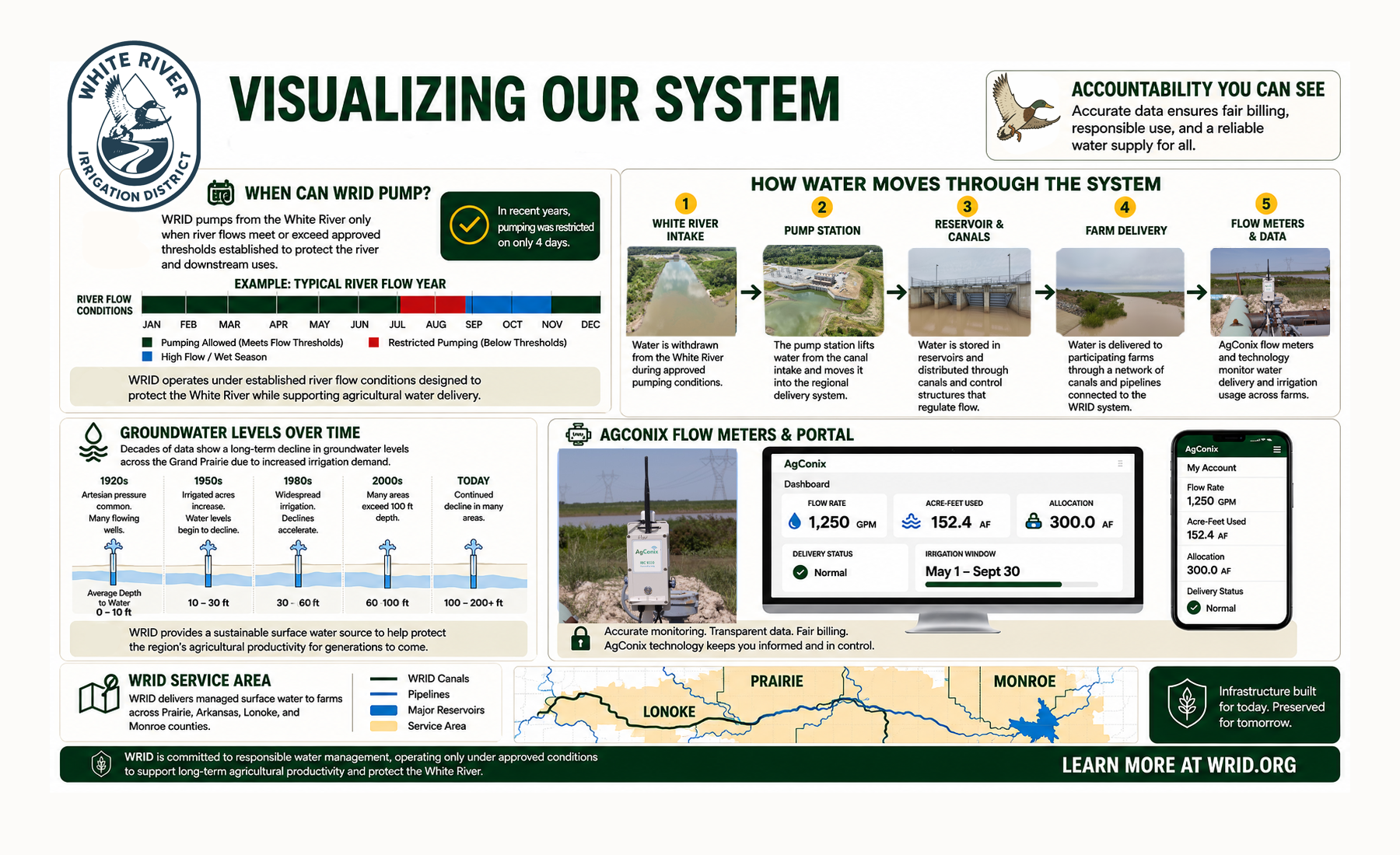
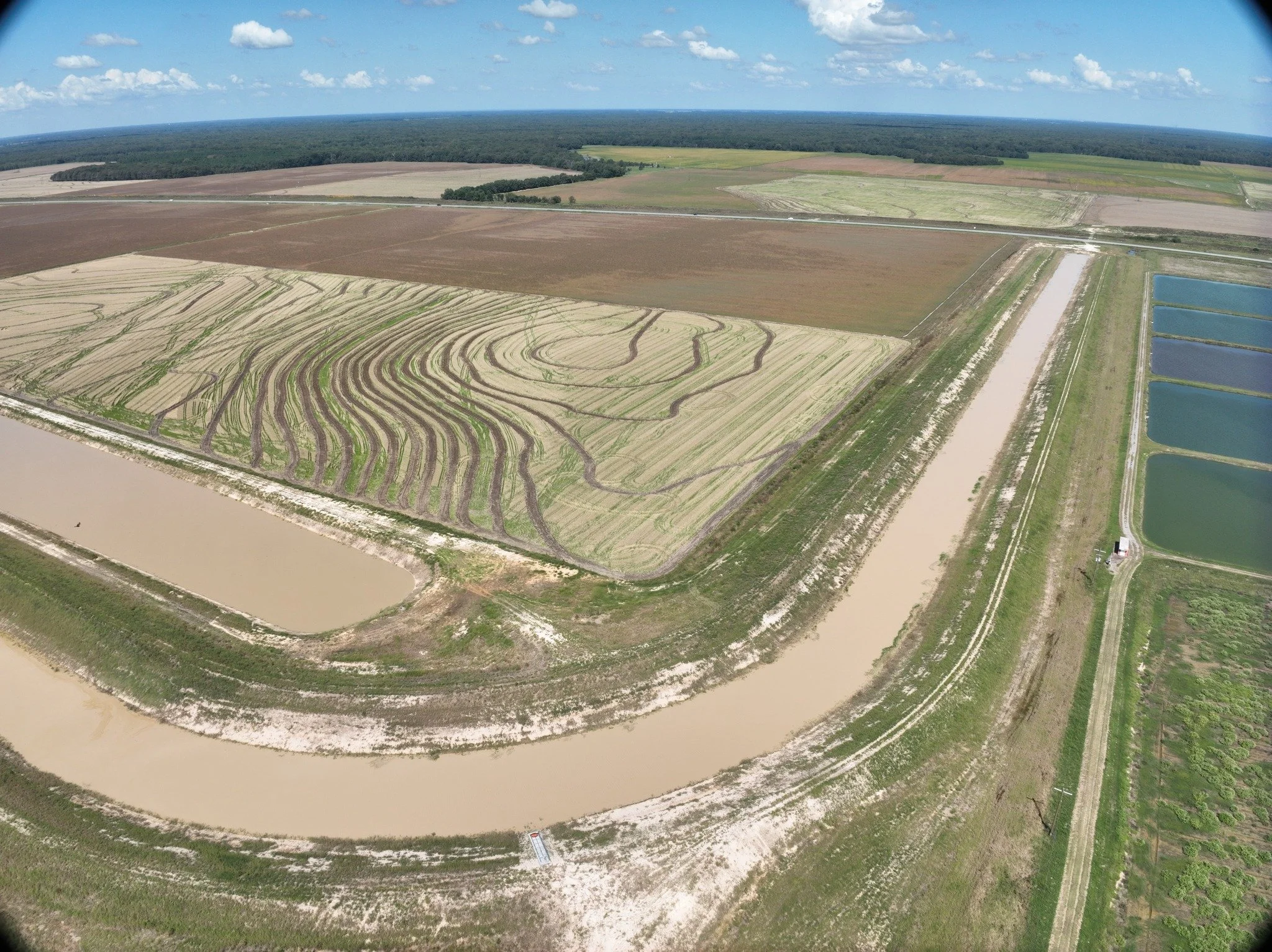
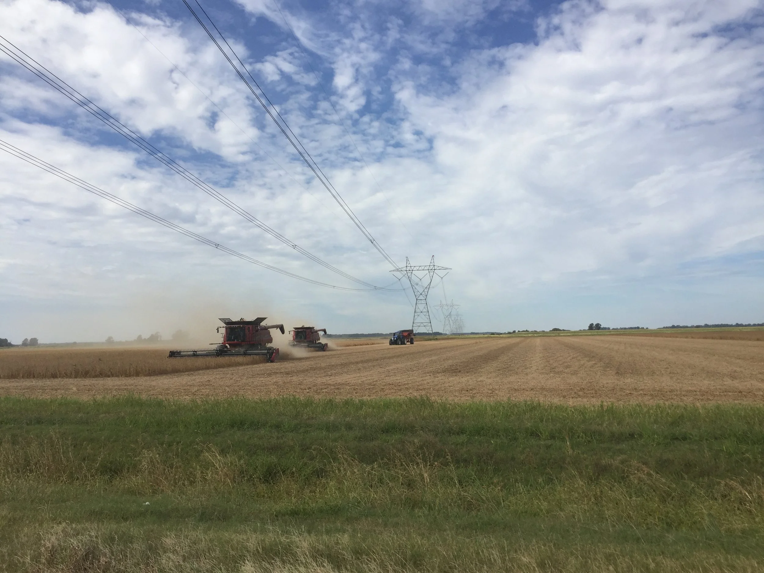
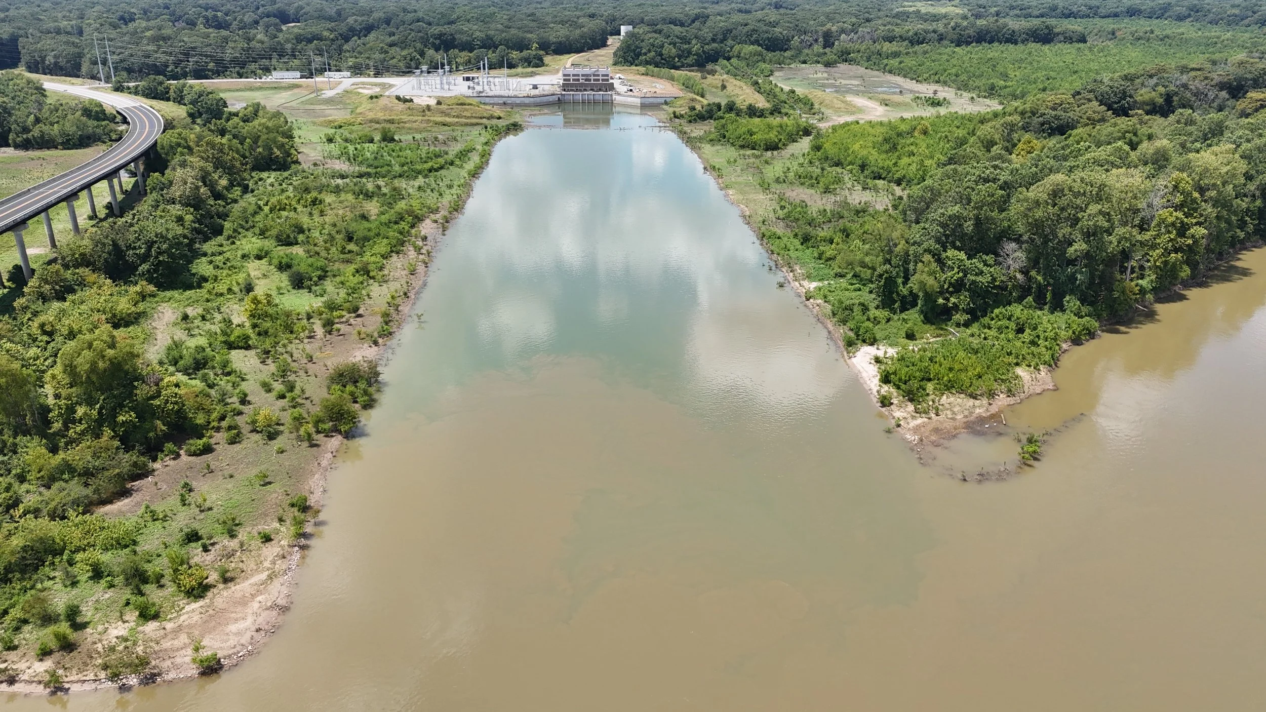
Water is lifted from the White River by a pumping station near DeValls Bluff and directed into a regulating reservoir. From there, a network of canals, pipelines, and control structures moves water across the Grand Prairie to participating farms.
The system operates as a coordinated delivery network designed to provide reliable surface water during periods of agricultural demand. Aerial Photo of Grand Prairie Pumping Station by 📸 Tim Ward, C.J. Mahan Construction Learn More
-
The Grand Prairie region is one of the most heavily irrigated agricultural areas in Arkansas. WRID was developed to help provide an additional surface water source to support long-term irrigation needs across the region. Learn More
The White River Irrigation District (WRID) was created to secure a sustainable water future for agriculture in Arkansas’s Grand Prairie region. For decades, farmers in this area have relied heavily on groundwater from the Alluvial and Sparta Aquifers. As those aquifers have declined, the need for a long term surface water solution became critical.
White River Irrigation District
WRID is leading a multi-decade effort to deliver surface water from the White River directly to area farms, reducing dependence on groundwater while protecting one of Arkansas’s most important agricultural regions.
Farmers
Access water service information, account tools, delivery resources, and irrigation system details for participating farms across the Grand Prairie region.
Learn about service areas, contracts, delivery infrastructure, and how to begin receiving water through WRID.
HOW DO I BUY WATER?
Access account information, water usage, flow meter data, billing, allocations, and irrigation management tools.
FARMER PORTAL
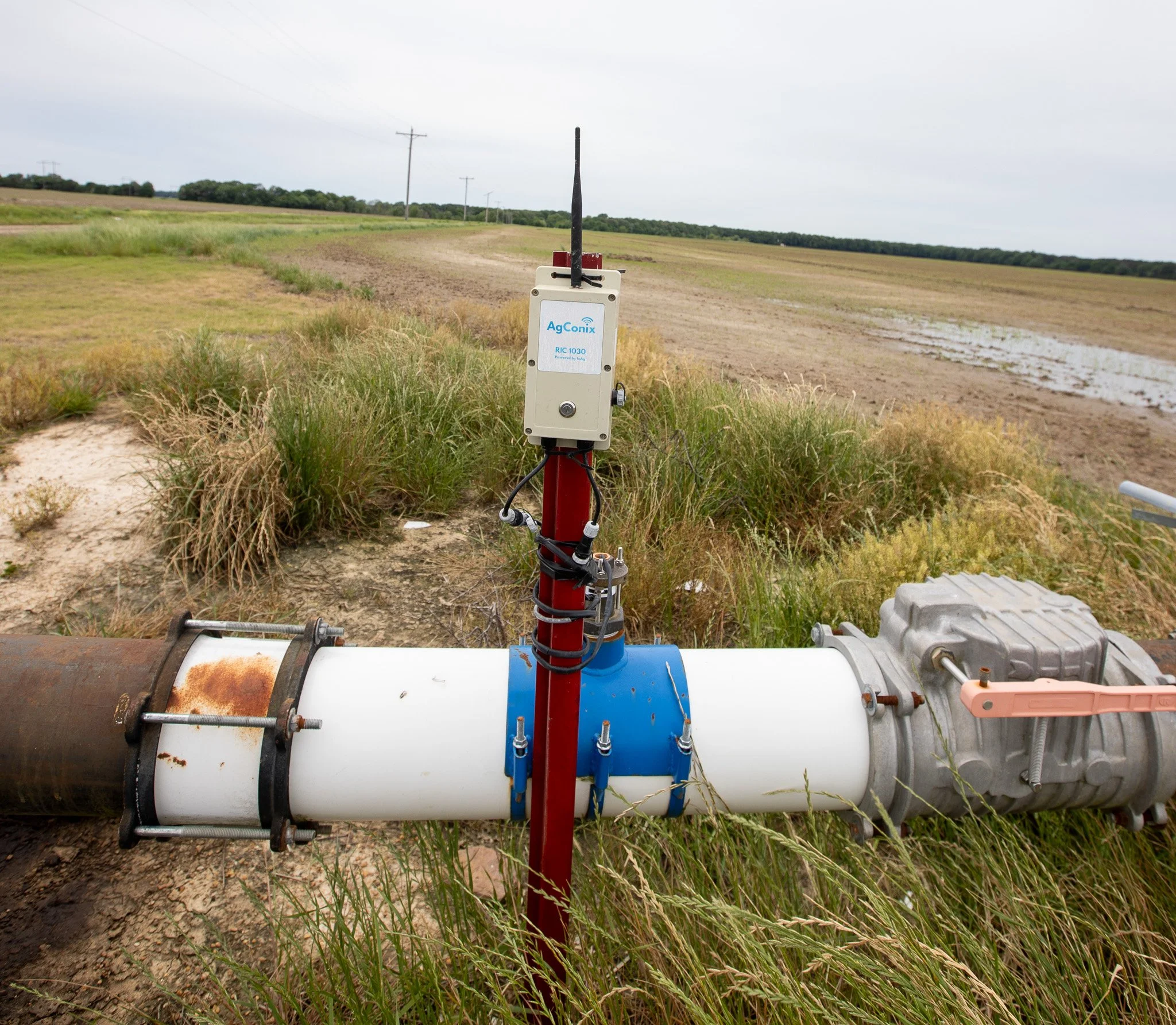
WRID uses flow meters and AgConix technology to monitor water delivery and track irrigation usage across participating farms.
METERING & DATA
Frequently Asked Questions
-
xxxxxx
-
xxxx
-
xxxxx
-
You can reach us anytime via our contact page or email. We aim to respond quickly—usually within one business day.
-
We offer flexible pricing based on project type and complexity. After an initial conversation, we’ll provide a transparent quote with no hidden costs.
-
We offer a range of solutions designed to meet your needs—whether you're just getting started or scaling something bigger. Everything is tailored to help you move forward with clarity and confidence.
-
xxxxxx
-
We combine a thoughtful, human-centered approach with clear communication and reliable results. It’s not just what we do—it’s how we do it that sets us apart.
-
2026
-
Grand Prairie Region: Prairie, Arkansas, Lonoke & Monroe Counties
Every event we host is designed with intention, from the atmosphere we create to the way each session flows.
01
Intentional
Structure
02
Collaborative
Energy
03
Expert
Facilitation
The maps below provide regional data on groundwater levels, aquifer trends, and irrigation demand across eastern Arkansas.
-
![]()
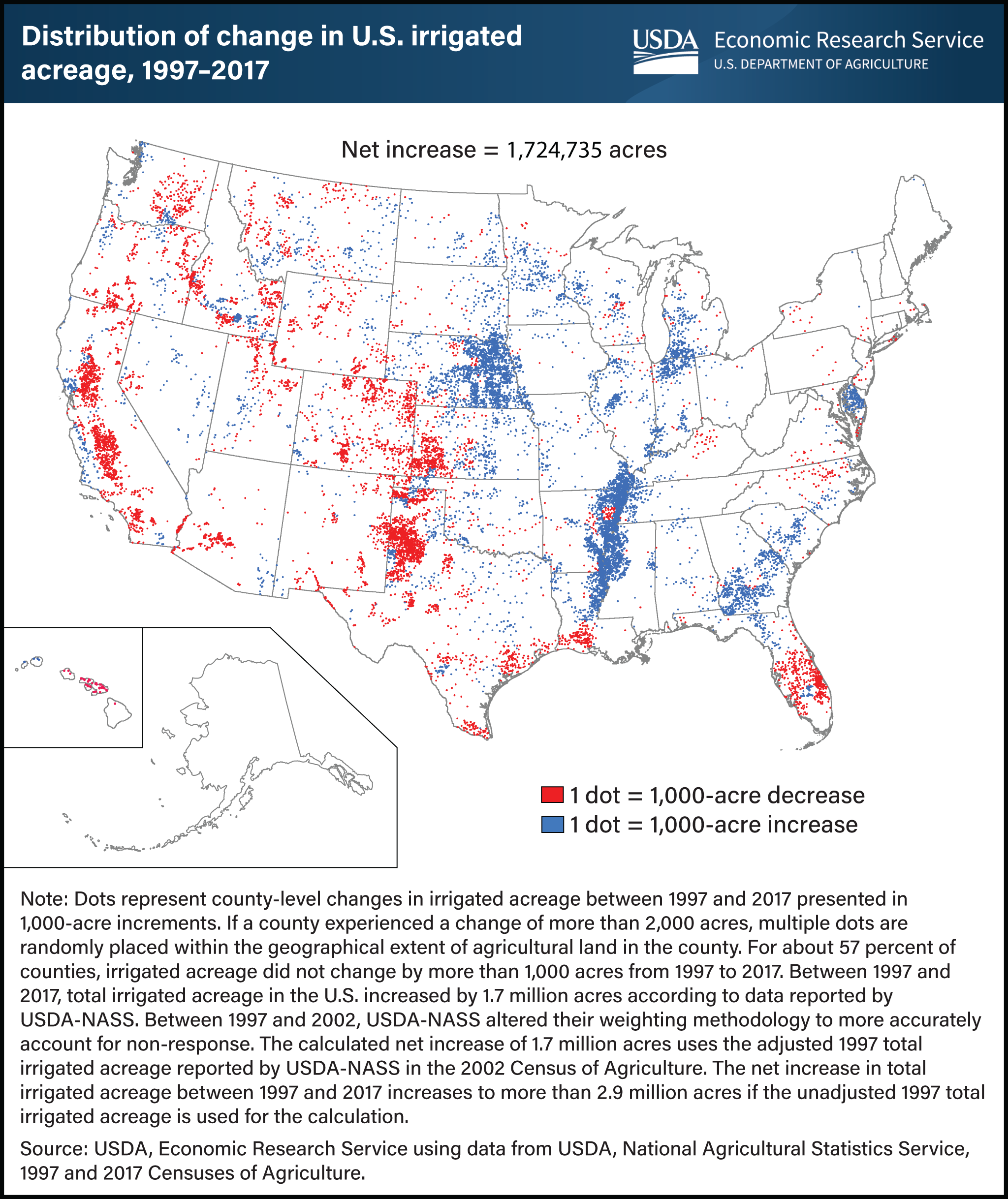
Irrigation Demand Has Expanded Nationally This USDA map shows changes in irrigated acreage across the United States between 1997 and 2017. Eastern Arkansas experienced significant increases in irrigated agriculture during this period, reflecting the region’s importance in rice, soybean, corn, and other row crop production. As irrigation acreage increases, so does demand on groundwater resources. In regions that rely primarily on aquifers, expanded irrigation can accelerate declines if groundwater withdrawals consistently exceed recharge. The challenge facing the Grand Prairie is not unique. Agricultural regions across the country are working to balance crop production, water availability, and long-term sustainability.
-
![]()
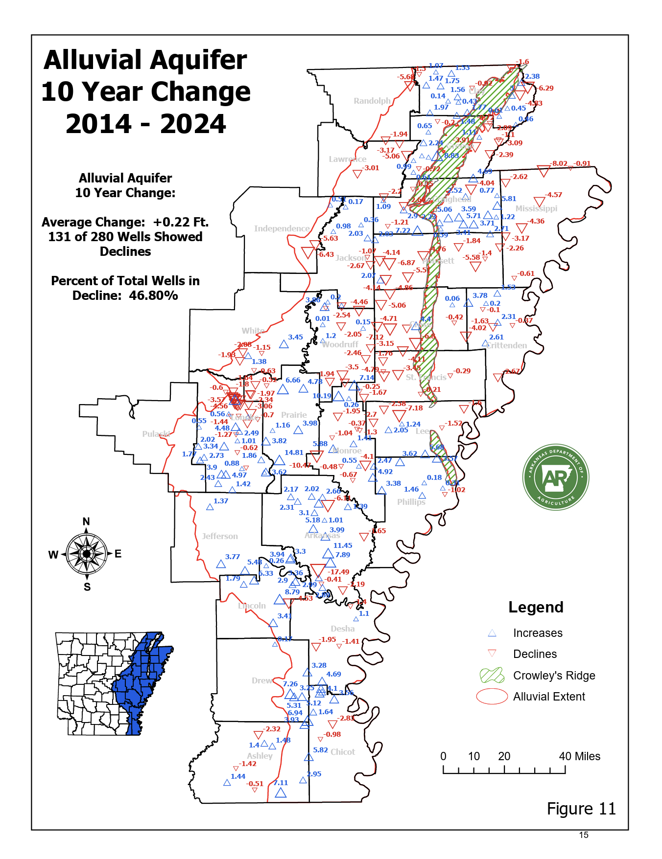
10 Year Change 2014–2024 This map compares groundwater levels over a ten-year period from 2014 to 2024. While some areas experienced stable or improving conditions, nearly half of monitored wells recorded declines over the decade. Long-term groundwater trends are important because they show whether the aquifer is recovering, stabilizing, or continuing to lose storage capacity over time. Sustained declines can affect irrigation reliability, increase operational costs for producers, and place additional pressure on remaining groundwater supplies during drought years. The long-term goal of regional water management efforts is to slow or reduce groundwater depletion while maintaining agricultural productivity across eastern Arkansas.
-
![]()
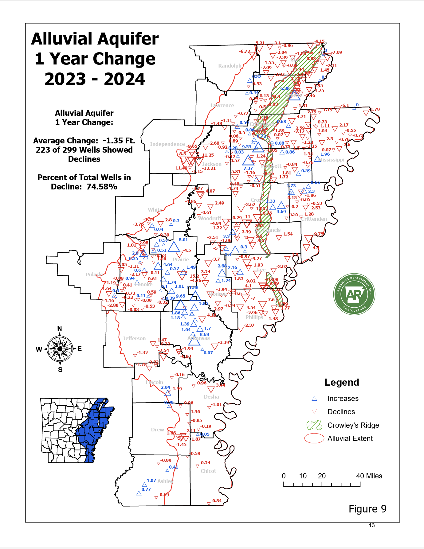
Short-Term Groundwater Changes This map shows one-year groundwater level changes between 2023 and 2024. Red symbols represent wells where water levels declined. Blue symbols represent wells where levels increased. In 2024, approximately 75% of monitored wells showed declines, with an average decline of 1.35 feet across the monitored area. Annual conditions can vary depending on rainfall, crop demand, and irrigation intensity. However, repeated short-term declines over multiple years can contribute to longer-term stress on the aquifer system. Monitoring annual changes helps water managers track where declines are accelerating and where conservation or supplemental surface water may be needed.
-
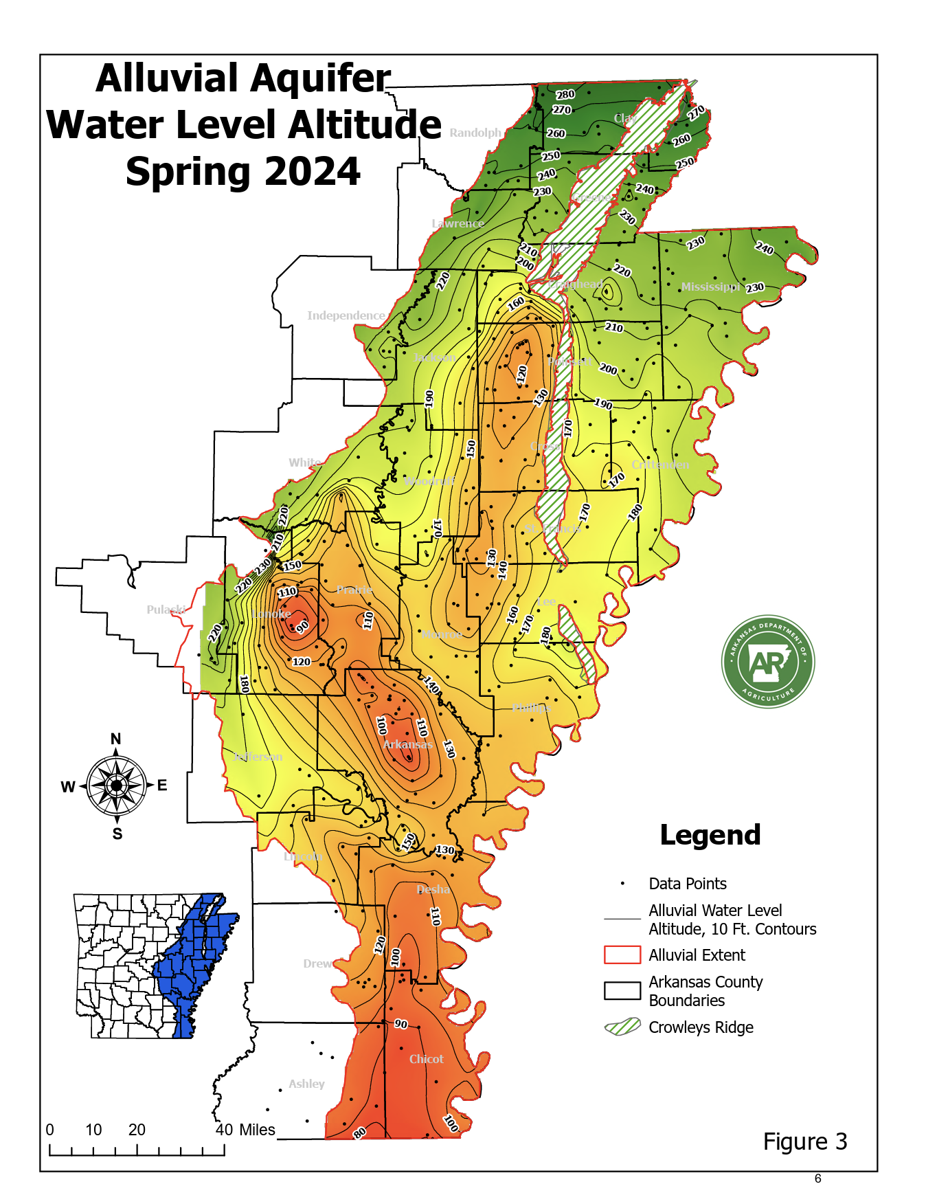
![]()
Current Groundwater Elevations Across the Alluvial Aquifer The contour lines illustrate how groundwater moves across the region. Areas with lower water elevations indicate portions of the aquifer under greater stress from long-term pumping demand. In parts of the Grand Prairie, groundwater levels have declined enough to create localized depressions in the aquifer. These areas can experience reduced well performance, higher pumping costs, and increased concern about long-term water availability for irrigation. The White River Irrigation District project is designed to reduce dependence on groundwater by supplementing irrigation needs with surface water from the White River during periods of agricultural demand.

Why Water Reliability Matters
Water availability affects irrigation reliability, operating costs, long-term farm planning, and regional agricultural productivity across eastern Arkansas.
-
![]()
Monet Goode
FOUNDER
With a vision for building something meaningful, our founder brings a blend of big-picture thinking and hands-on experience.
They set the tone for everything we do. -
![]()
Groundwater Conditions
Groundwater monitoring across eastern Arkansas shows areas where aquifer levels have declined over time due to irrigation demand exceeding natural recharge.
View Aquifer Data → -
![]()
Eleanor Parks
MARKETING DIRECTOR
Creative and strategic in equal measure, our marketing director brings fresh ideas to every campaign. They turn insights into action and help our message resonate with the right audience. -
![]()
Karl Holland
CUSTOMER SERVICE MANAGER
Friendly, attentive, and always ready to help, our customer service manager ensures every interaction is a positive one. They keep communication clear, timely, and human.

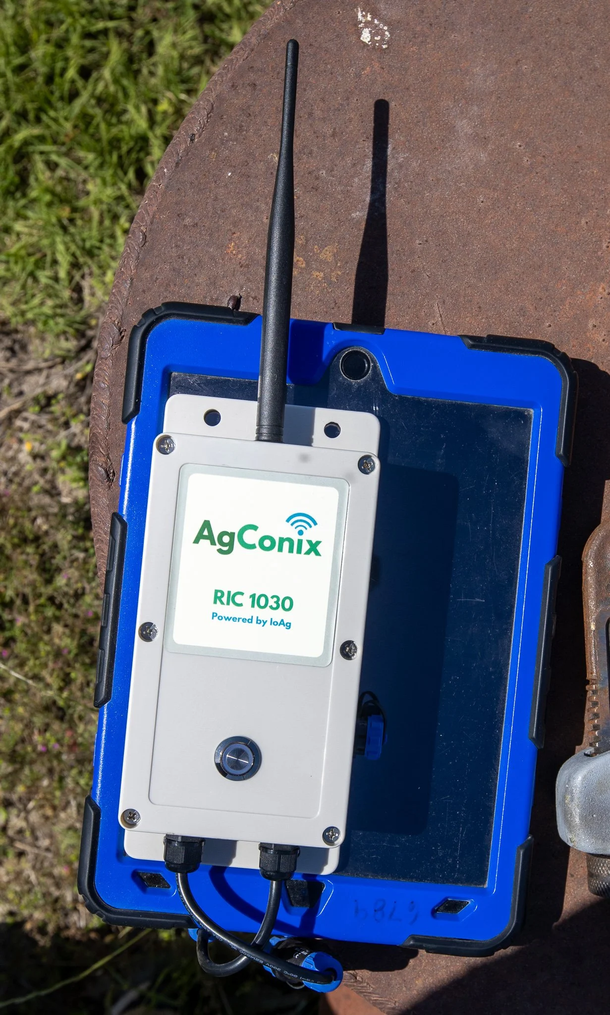
MEASURING DEVICES
-
The White River provides the surface water that powers the irrigation system. Pumping occurs only when river levels are above a predetermined cutoff designed to protect the river and maintain minimum flows during drought conditions.
Water enters an inlet canal and flows to the district’s pump station near DeValls Bluff, where it begins its journey across the Grand Prairie irrigation network.
-
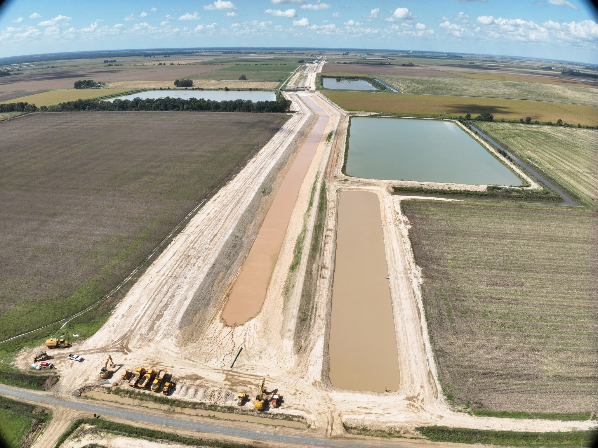
Construction is actively progressing across multiple components of the project, including canal segments, road crossings, and pump station infrastructure. The electrical substation has been completed, and system integration is underway. The project remains on track for initial water delivery in 2026.
-
The project is funded through a combination of federal investment and state supported financing.
Federal partners provide approximately 70 percent of total funding, primarily through the U.S. Army Corps of Engineers and the Natural Resources Conservation Service.
The remaining 30 percent is financed through loans obtained by the White River Irrigation District through the Arkansas Department of Agriculture.
These loans are repaid through water sales, with the goal of delivering an affordable and reliable water supply to farmers.
Grand Prairie Area Demonstration Project (GPADP) represents a generational investment in Arkansas agriculture. It is designed to help ensure the Grand Prairie remains productive and economically strong for decades to come.
-
Groundwater in the Grand Prairie is declining, and current use is not sustainable. Because the change happens slowly underground, the urgency is not always obvious, but the consequences are significant.
Without a reliable water source, much of the region’s farmland would lose irrigation, affecting farmers, local businesses, and the economy.
This project provides a long term solution by delivering surface water from the White River, giving farmers a reliable and affordable supply.
Without it, the region’s farming, economy, and way of life will not exist as they do today.
-
The U.S. Army Corps of Engineers leads major infrastructure, including the pump station and reservoir. The Natural Resources Conservation Service supports design and funding for canals and pipelines. The Arkansas Department of Agriculture provides financing, while the White River Irrigation District coordinates construction and local implementation. Additional partners support environmental and conservation efforts.
-
Description text goes here
The Project
Working in partnership with the U.S. Army Corps of Engineers Memphis District and regional stakeholders, WRID is implementing the Grand Prairie Area Demonstration Project (GPADP).
The system includes:
A major pumping station near DeValls Bluff
A network of canals, including Canal 1000
Approximately 40 miles of irrigation pipelines
Connections to on-farm reservoirs
Infrastructure designed to serve approximately 40,000 to 60,000 acres of farmland
This integrated network delivers White River surface water to rice and other crop producers throughout the Grand Prairie region, including areas near Stuttgart, Ulm, and Slovak.
How it Works
Water is lifted from the White River by a pumping station near DeValls Bluff and directed into a regulating reservoir. From there, a network of canals, pipelines, and control structures moves water across the Grand Prairie to participating farms. The system is designed to operate as a coordinated delivery network, providing reliable surface water where it’s needed most.
WRID’s delivery system is designed to provide participating farms with reliable access to surface water for irrigation. Learn more about service areas, connection information, and what to expect as water delivery begins.
-
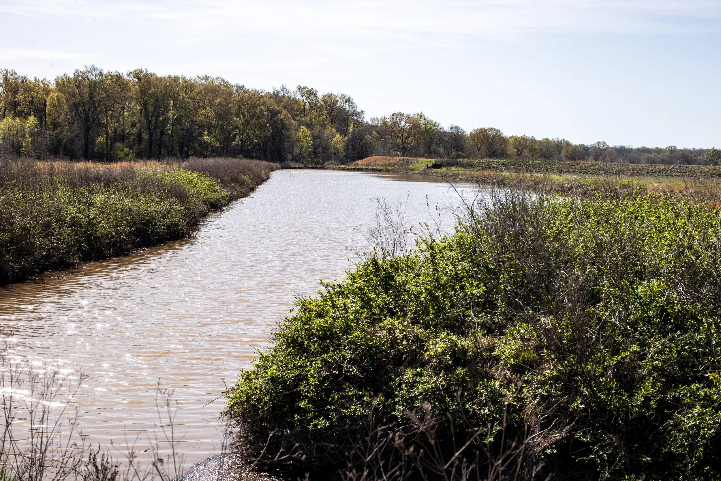
The canal system forms the backbone of the district’s water distribution network. Water flows from the regulating reservoir through a series of engineered channels and control structures that move water across the Grand Prairie.
Earthen levees maintain the depth and capacity needed for gravity flow, allowing water to travel efficiently across the region before entering pipelines that deliver water to farms.
-
The District incorporates Arkansas Grand Prairie native grasses along its levees and rights-of-way as part of its environmental mitigation efforts. These deep-rooted grasses help stabilize soil over time, improve long-term resilience, and restore a landscape that once defined the region. Seed is harvested locally from existing prairie remnants, supporting conservation while allowing landowners to retain ownership and use of their property. LEARN MORE
-
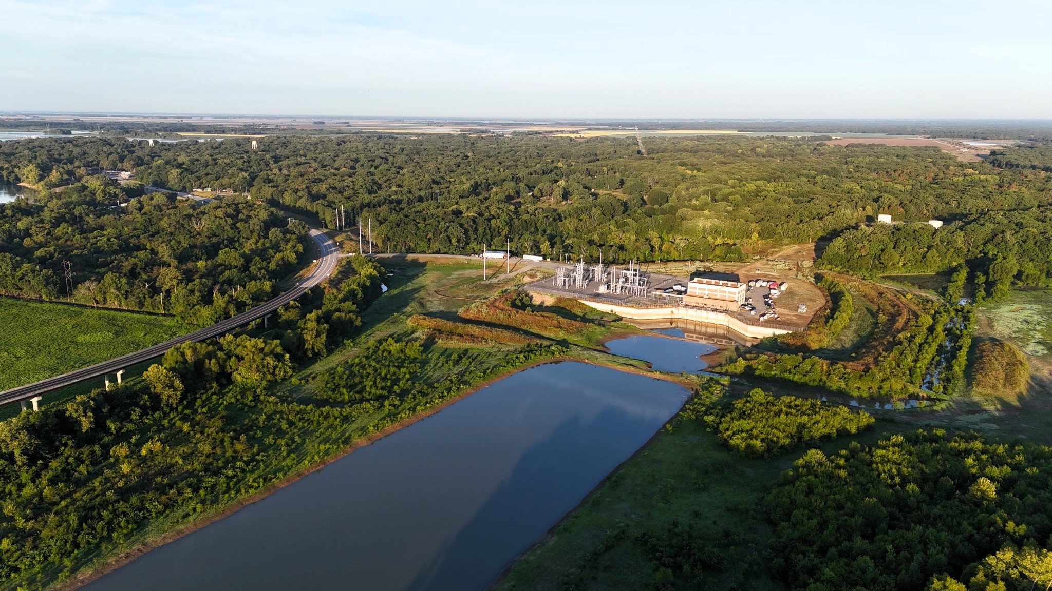
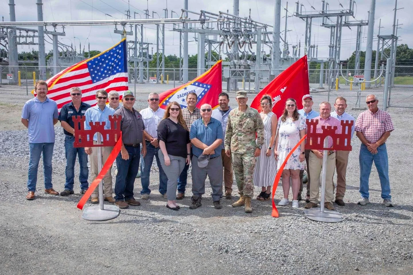
![]()
WRID celebrated the $15.7M Grand Prairie Electrical Substation completion with a ribbon cutting Monday in DeValls Bluff.
-
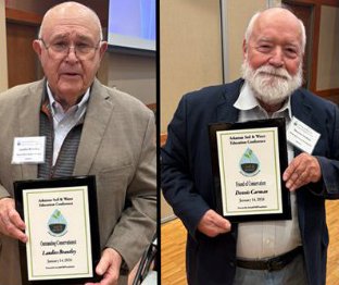
![]()
Laudies Brantley and WRID’s Dennis K. Carman were recognized at the 28th annual Arkansas Soil and Water Education Conference & Irrigation EXPO for Outstanding Conservationist and Friend of Conservation, respectively.
-
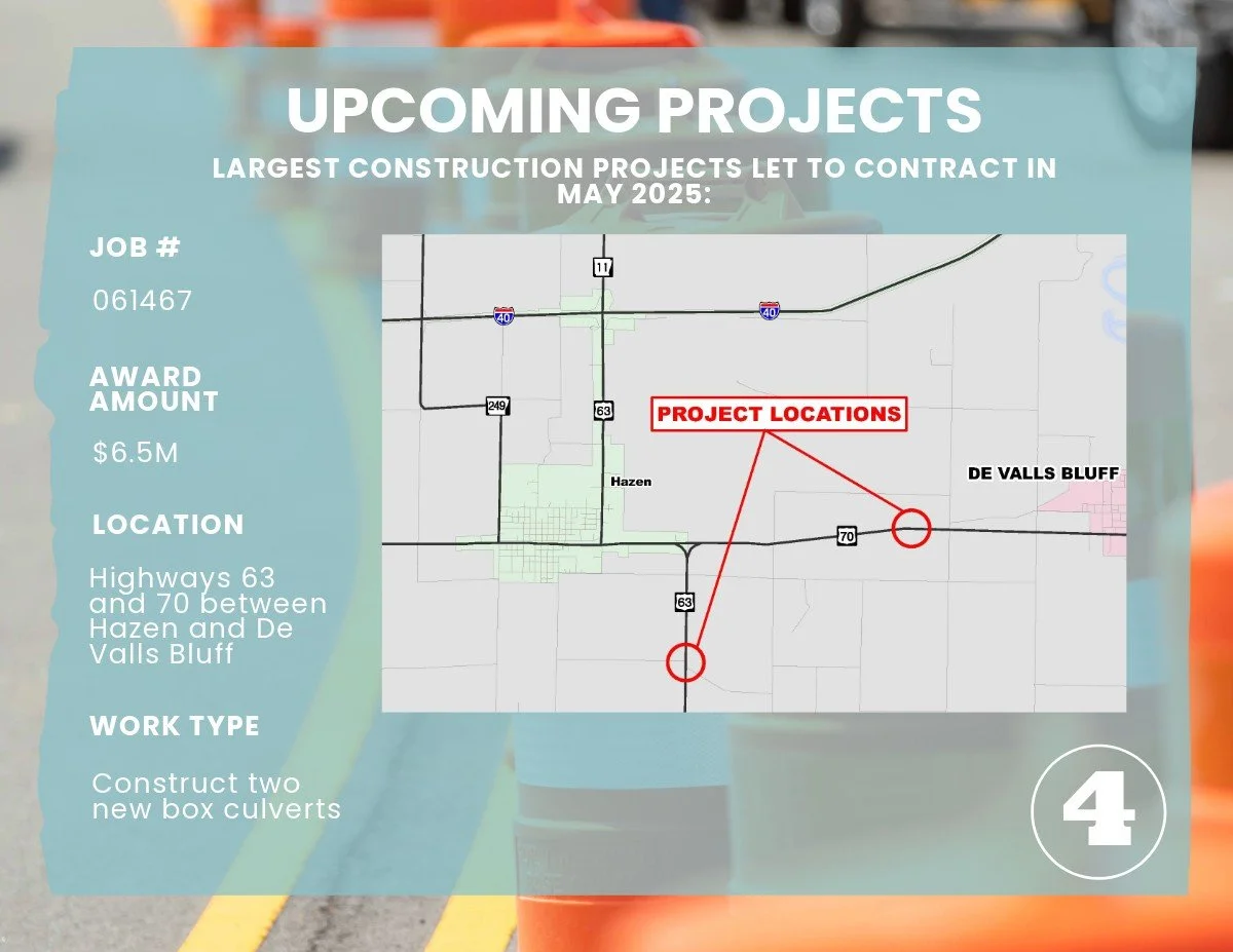
![]()
ArDOT Highway 70 and 63 crossings are underway, with culverts delivered, utilities relocated, and RedStone Construction Group leading construction.
-
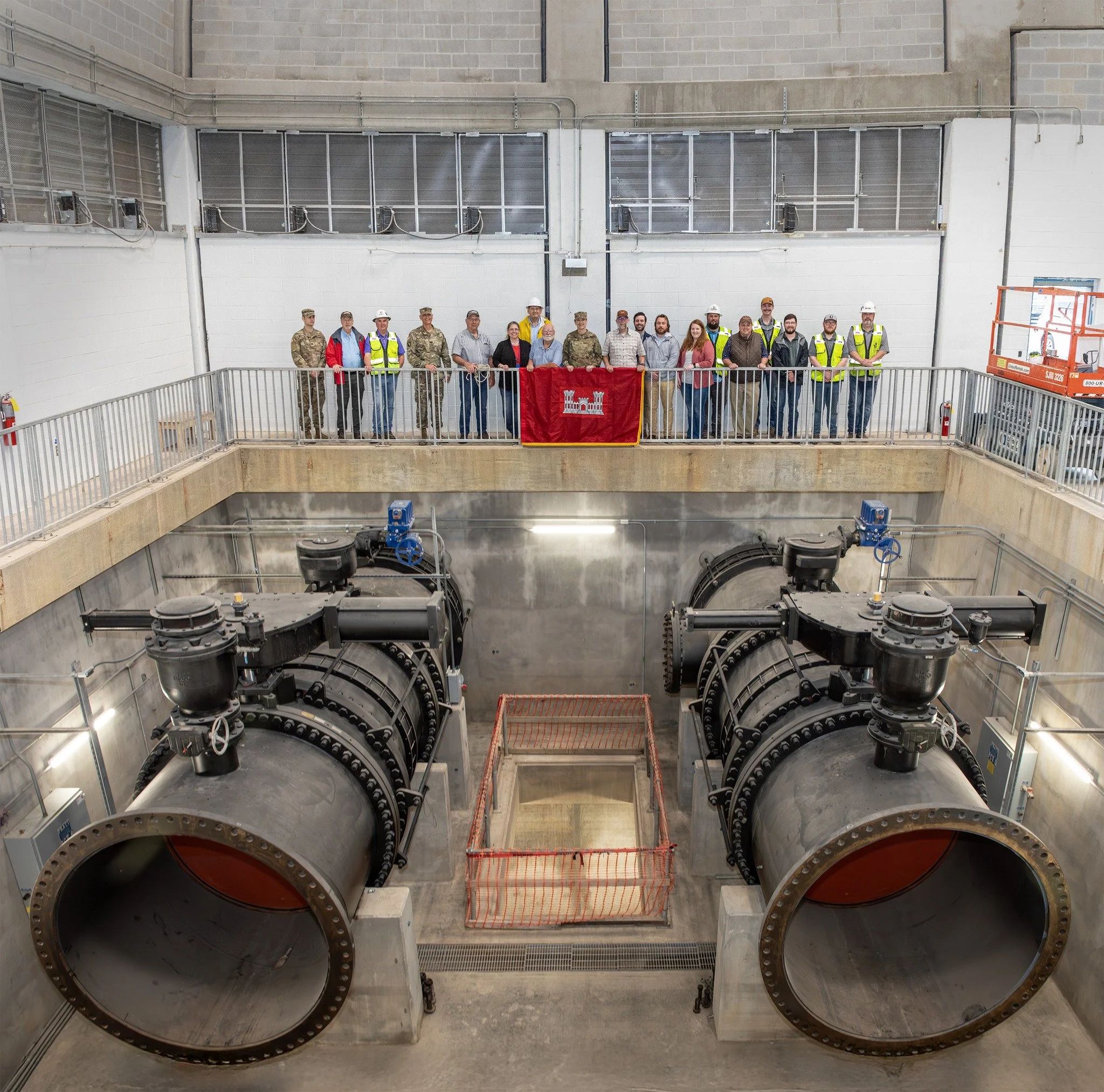
![]()
The Grand Prairie Pumping Station remains on schedule for 2026. Construction includes pumps, surge tanks, major pipelines, and a regulating reservoir, with the electrical substation now complete. The project is moving into final system integration and testing.
-
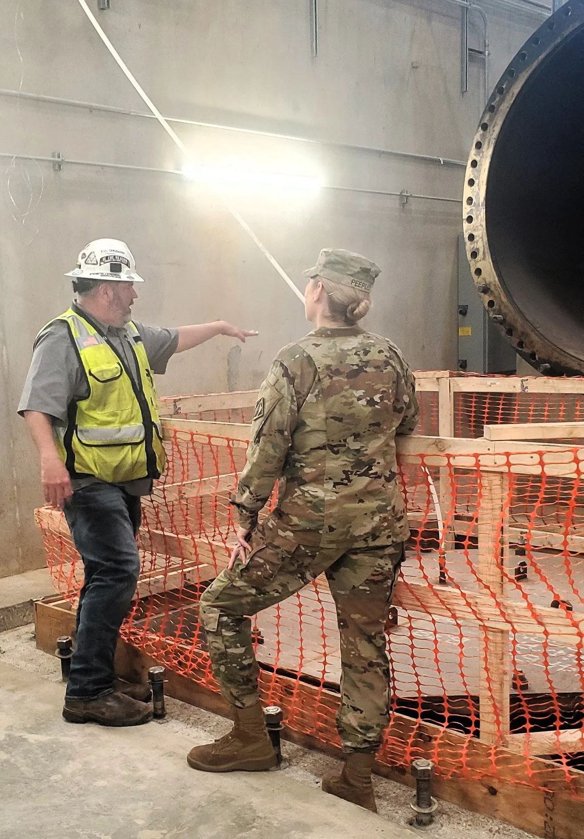
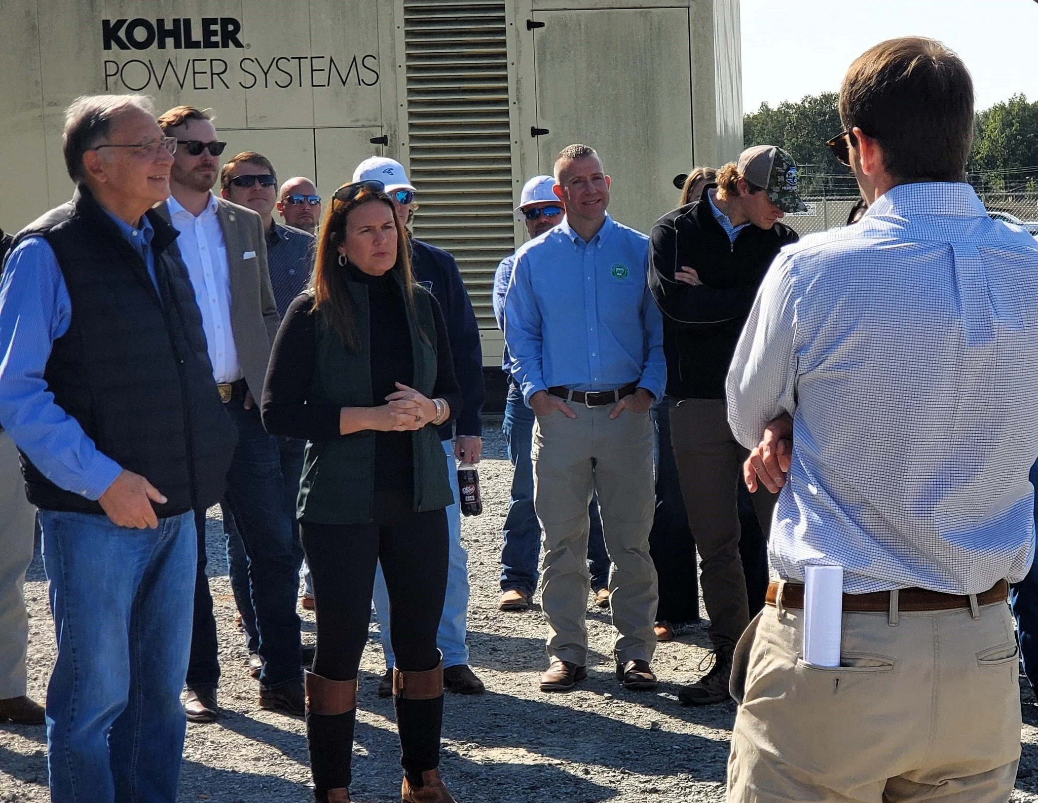
![]()
Governor Sarah Huckabee Sanders and U.S. Senator John Boozman toured WRID’s pump station and canal construction sites in DeValls Bluff and near the Hazen airport. Board President Dan Hooks hosted the visit, joined by State Senator Ron Caldwell, Representative Jeremiah Moore, and other state and federal partners.
-
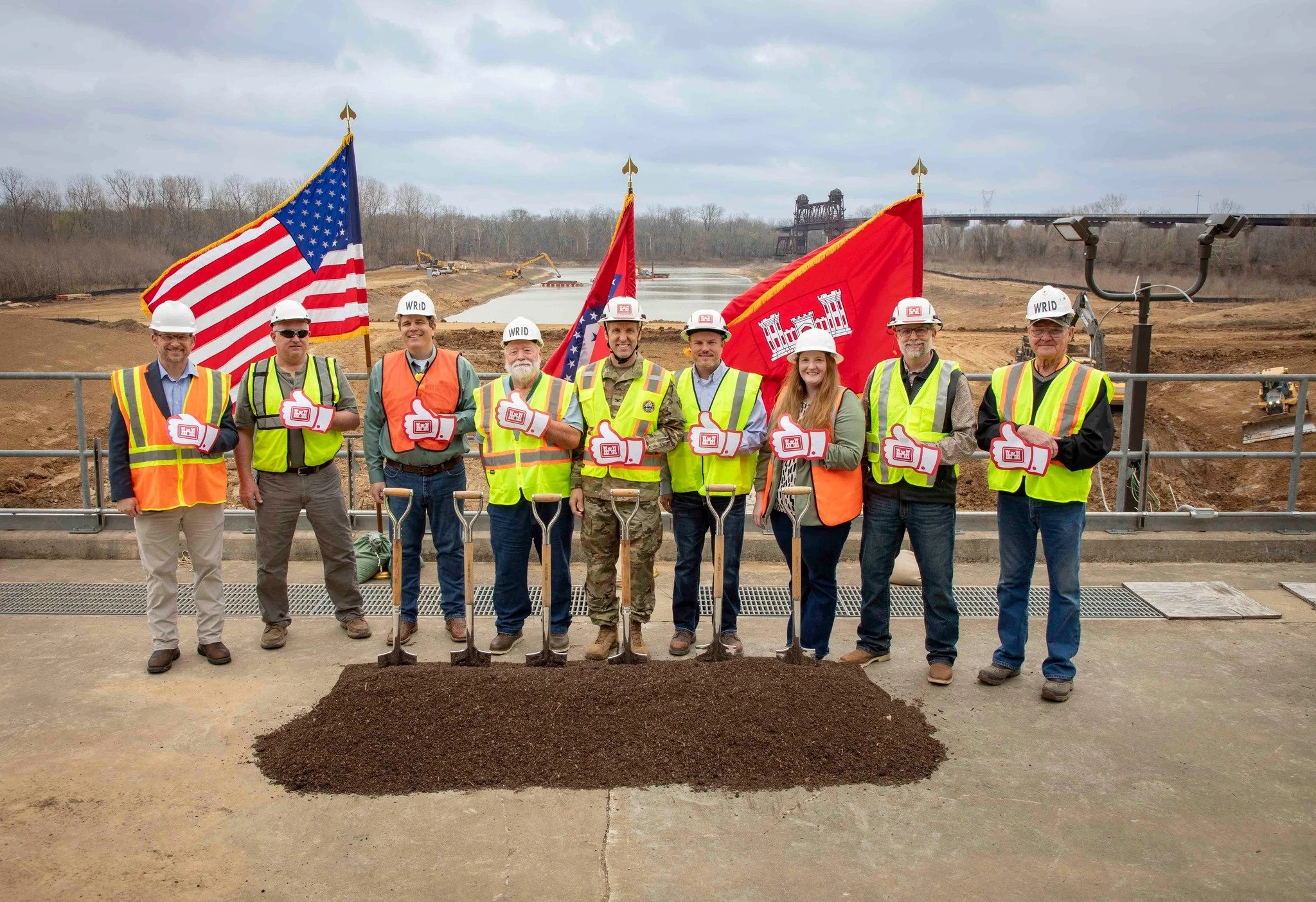
![]()
March 2026 — The U.S. Army Corps of Engineers Memphis District celebrated new milestones for the Grand Prairie and Bayou Meto irrigation projects in eastern Arkansas. (Photo: USACE / Vance Harris)
-
![]()
USACE Memphis District awards contract to complete the Grand Prairie Pump Station Inlet Channel, a critical step toward delivering water to the Grand Prairie irrigation system.

Sign up to recieve project updates, articles, and road closures.
Sign up to receive project updates, articles, and road closures.